
![]()
![]()


75,118 feet above Idaho. This image shows a river and what appears to be lava fields (the large dark patches). The horizon is 335 miles away in this image. So parts of either the states of Wyoming and Montana or Washington and Oregon are visible at the horizon.
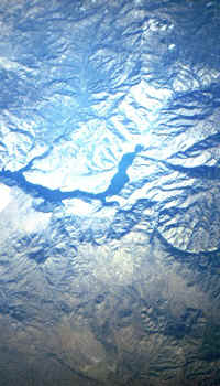
This image taken at 77,066 feet is of Anderson Ranch Reservoir. At the bottom of the image the valley. The top two thirds are mountains, with the
reservoir in the middle of the image. At the top can be seen small cumulus clouds
probably forming by orographic lift.
You can also notice a blue cast to the image. I believe the atmosphere below the nearcraft is responsible. Rayleigh scattering by the air below makes the ground blue from near space, rather than making the sky blue when observed from the ground.
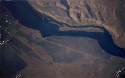
This image is of the Snake River flowing through a canyon in Owyhee county. The image was taken from an altitude of 16,000 feet. The sun is shining from the bottom of the image. The shadows of the canyon wall add a layer of complication to the image.